Lake plan expected by year’s end
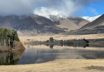
An action plan to improve the water quality in the Ashburton Lakes in Mid Canterbury's high country will be ready before the end of the year.
The Ministry for the Environment had earlier indicated the plan would be available shortly after it released a report on the continued deterioration of the network of wetlands and lakes.
According to the Ōtūwharekai/Ashburton Lakes lessons-learnt report, released on May 24, the lakes are close to flipping from clear weed-dominated water to turbid algae-dominated water - which would have a detrimental impact on lake ecosystems.
The report said “90 per cent or more” of the drop in water quality was due to leaching and run-off of nitrogen and phospherous from surrounding farm land.
However, the report also found that the neighbouring farms had met or exceeded the latest regulations - and suggested the regulations that had been set were not enough to save the lakes.
A working group was set up to create a plan for the catchment area to stop the lakes from flipping.
The working group is made up of local rūnanga with a connection to the area, Environment Canterbury (ECan), farmers in the area, the Department of Conservation, Land Information NZ, the Ashburton District Council, Central South Island Fish & Game, the Ministry for the Environment and the Ministry for Primary Industries.
ECan expects the plan will be ready before the end of the year.
Science director Dr Tim Davie said work on the plan had started under an independent contractor.
“Environment Canterbury is supporting the Ōtūwharekai Working Group to develop an integrated catchment plan for the Ōtūwharekai Lakes.
"The catchment plan will take in all of the research to date and set out a clear path forward to restore biodiversity and ecosystem health in this area.”
He expected the report to be complete before the end of the year.
Once complete, the plan would be shared with key stakeholders and the public, Davie said.
The plan will use data from national studies, such as the Lakes380 project, alongside modelling from monitored lakes in the catchment to set a baseline for measuring water quality.
Davie said a local "reference lake" in pristine condition would show the natural state for the lakes as well as reference for climatic influences and natural variability
However, the reference lake would need to be at a similar altitude and have a similar depth and size to the "impacted" lakes.
This ruled out an option such as Mystery Lake, he said.
While Mystery Lake was entirely within DOC land and not in a farm catchment the lake was about 300m higher and much smaller than the larger lakes in the catchment.
"Unfortunately, we do not have a true, unimpacted reference lake available that would be directly comparable to the likes of Lakes Clearwater and Heron.
"We monitor a number of lakes in the high-country that are mostly or exclusively on conservation estate. However, some have a history of farming land use - for example, Lake Emma," he said.
ECan used data from national studies that sampled lake cores to hindcast past water quality and a study modelling past trophic levels along with what little data was available from previous decades to estimate a natural state for the Ashburton Lakes.
"We believe this provides us with an effective baseline to assess the trophic levels and overall health of the lakes in Ōtūwharekai," he said.
Eight of the lakes are monitored. Lake Denny has the worst trophic level index, meaning it had the poorest water quality.
Neighbouring Lake Emma has ranked second for poor water quality followed by Lake Heron and the two Maori Lakes.
Lake Camp had the best water quality, followed by Lakes Emily and Clearwater.
None meet the freshwater management goals for trophic levels.
By Sharon Davis